The Bulletin from 5,359 Metres: A Ladakh Road Trip in Four Elevations
A meteorologist drives Leh to Khardung La to Pangong Tso to Nubra Valley and files four days of conditions reports along the way.

3,500 Metres, Clear Sky, Thin Air: Leh's Opening Bulletin
Twelve degrees Celsius at ten in the morning, sky doing that flat cloudless blue that thin air produces when there isn't enough water vapour left to scatter the light sideways, oxygen partial pressure sitting at roughly two thirds of what it is at sea level. That was Leh's arrival bulletin, delivered by a dull pressure headache before the plane had even finished its taxi.
The standard advice for the first day at 3,500 metres is to do nothing, and for once the standard advice is correct. I sat on the guesthouse rooftop, drank more water than I wanted, and watched the light do the thing it does at this altitude, harder-edged than it has any business being, shadows cut clean instead of softened. No exertion, no alcohol, no arguing with the body about what it can handle at a third less oxygen than it's built for. By evening the headache had backed off to a dull hum. That's acclimatization working, not the place being unkind.
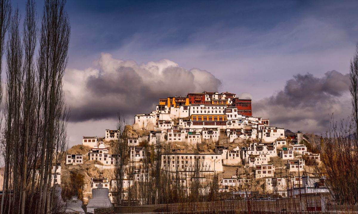
Day two, cleared for gentle movement, we drove up to Thiksey Monastery, stacked white and ochre against the hillside above the Indus valley, monks' maroon robes moving between courtyards in a wind that had picked up out of nowhere by midmorning. The light came in low and sideways off the mountains behind it, throwing the whitewash into a brightness that made you squint even through sunglasses. A monk spinning prayer wheels along the lower wall didn't look up once. Good discipline, that, ignoring tourists mid-forecast.
Outlook for the rest of the week: dry starts, hard-edged light, and a climb to just over 5,300 metres by Thursday.
Acclimatization, Not Optional
Spend at least one full day in Leh (3,500m) before any drive higher; altitude sickness doesn't care how fit you are at sea level.
Drink more water than feels necessary; dry desert air pulls moisture off you faster than you'll notice at altitude.
Watch for headache that worsens, nausea, or breathlessness at rest — those are instructions to descend, not push through.
Ask a doctor before the trip about acetazolamide (Diamox) as a preventive; it's a medical call, not a packing-list item.
5,359 Metres, Wind Out of the West, Snow on the Shoulders: Khardung La
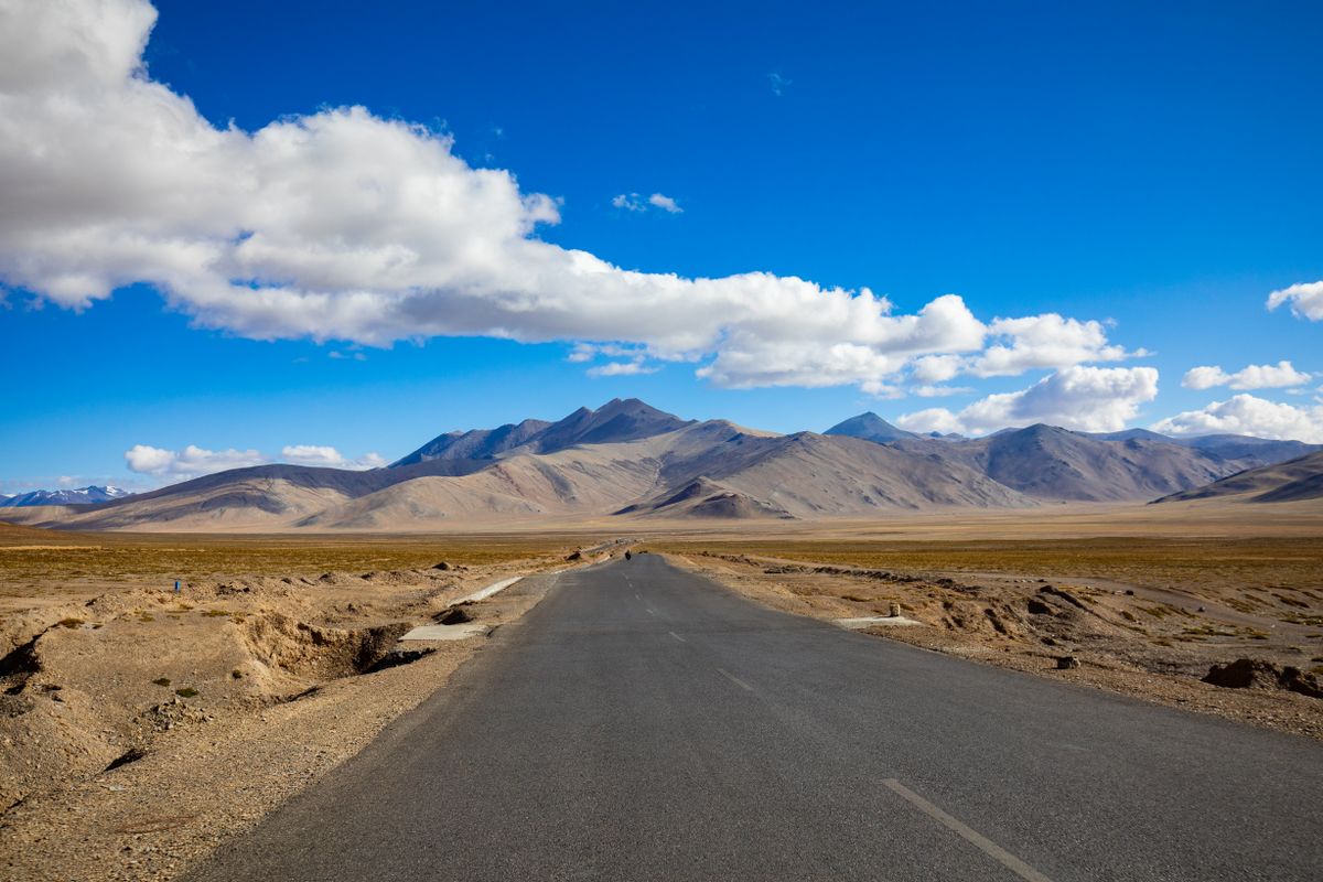
Minus two Celsius at the top, wind out of the west at what felt like a steady 20 knots, snow banked against the rock cuttings on the north-facing switchbacks even in a month that has no business seeing snow at lower elevations. That was Khardung La's bulletin, and it started announcing itself about forty minutes below the summit, when the tar gave way to gravel and the prayer flags strung along the final kilometre began snapping instead of hanging.
At the top, a sign maintained by the Border Roads Organisation states the elevation as 5,602 metres and calls this the world's highest motorable pass. My phone's barometric altimeter, which has no stake in national pride, read 5,359. Somewhere in that 243-metre gap sits a few decades of a nicer number outliving the survey that corrected it, and Khardung La isn't even Ladakh's highest pass any more; Umling La, further east, clears it by a wide margin. Local folklore holds that the sign is right because it's carved in stone and stone doesn't lie. Actual measurement holds otherwise. Same mountain, different instruments.
Two backpackers off a tour bus posed for photos at the sign in flip-flops. Forecast for their feet: 90% chance of regret within the hour, confidence high, no further updates required.
Outlook for the descent: the same wind dropping fast below 4,800 metres, and warmer air waiting in the valley on the other side.
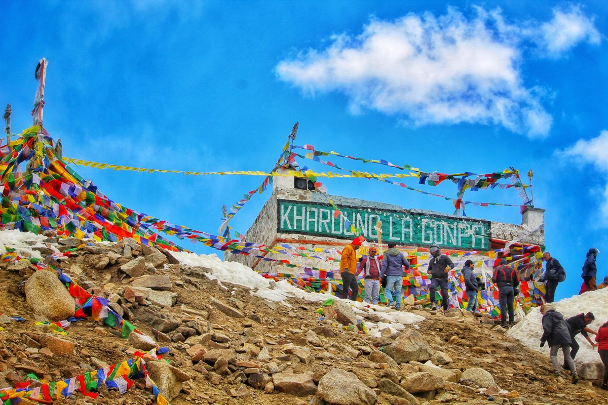
The sign claims 5,602 metres. My altimeter says 5,359. The other 243 are wishful thinking.
4,225 Metres, Flat Calm at Dawn: Pangong Tso Changes Colour on Schedule
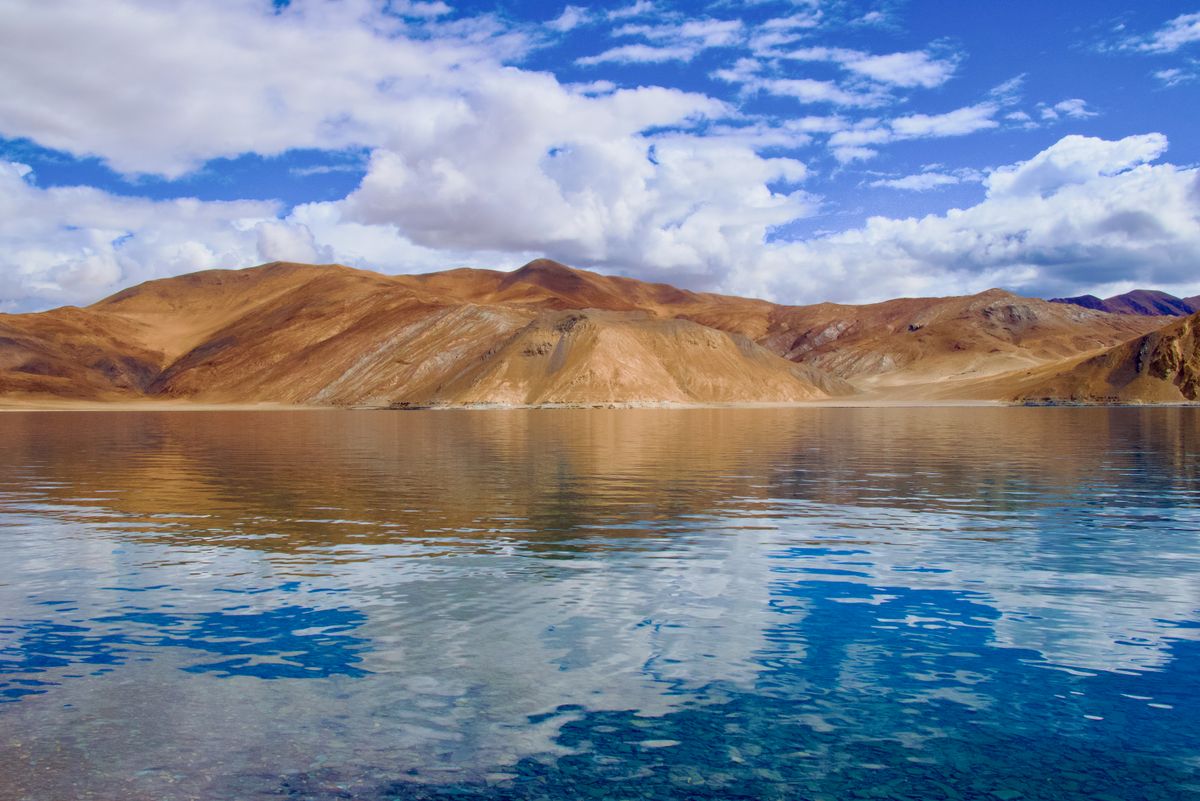
One degree Celsius at first light, water flat calm, lake surface reading almost black under a sky still holding its last stars. That was Pangong Tso before sunrise, a hundred-plus kilometres of it stretching east toward the line where India's side ends and the China-administered side begins, most of it out of sight around the curve of the mountains.
The local telling is that the lake changes colour by mood, blue in the morning, green by midday, grey when it's displeased. The actual mechanism is duller and more reliable: fine suspended mineral sediment scatters short wavelengths more as the wind picks up and stirs the shallows, while the angle of the sun through thinner and thinner air shifts which wavelengths dominate as the day goes on. By early afternoon the water had gone a turquoise you'd assume was edited if you saw it on a screen instead of standing in front of it, then dulled toward slate as cloud moved in from the west by four. Same lake, different light, entirely explainable.
Outlook for the night: temperatures below freezing, tents included, stars uninterrupted by cloud or light pollution for the first time all trip.
Getting to Pangong Tso: Permit Bulletin
An Inner Line Permit is required for both Indian and foreign nationals; the lake sits close enough to the border to count as a restricted zone.
Permits are typically arranged in Leh, through a registered travel agent or the online portal, a day or two ahead of departure.
Carry photocopies of ID and the permit itself; there's a checkpoint at Chang La on the way in that will ask for both.
Camp accommodation near the lake sits above 4,200 metres — treat the night there as another altitude night, not a rest stop.
2,800 Metres, Ten Degrees Warmer, Dry as a Bone: Descending into Nubra Valley
Twenty-two degrees Celsius by early afternoon, humidity low enough that sweat evaporates before you notice you're sweating, sky doing the same relentless clear it's done every day this trip. That's Nubra Valley's bulletin, and the ten-degree jump from Pangong Tso is mostly altitude, dropping back down through Khardung La and out the far side into a pocket of cold desert that somehow runs even drier than Leh.
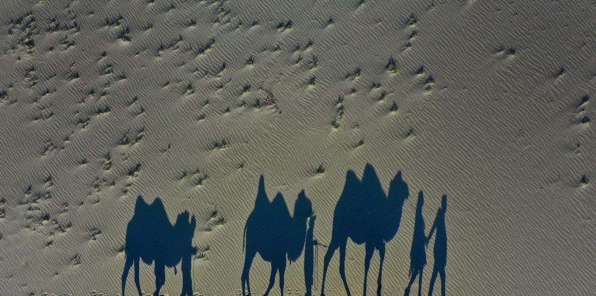
The dunes near Hunder sit where nobody expects sand in a mountain range, pale and rippled, holding the day's heat back into the evening the way sand does everywhere. A line of double-humped Bactrian camels, the kind bred for exactly this kind of high, dry cold rather than the single-humped kind further south, crossed the ridge as the sun dropped low enough to stretch every shadow to three times its owner's height. The light here does something the other three stops didn't: it goes gold instead of white, dust in the air catching the low angle and holding it.
Outlook for the drive back to Leh: same instruments, same disputed sign at the top, one more crossing of 5,359 metres before the road finally drops for good. ■