The Dzong at the Confluence: Two Rivers, One Argument
A glacially fed river and a moraine-dammed one converge beneath a 17th-century dzong, and the valley's 1994 flood explains why the newest bridge here has concrete hidden inside the wood.

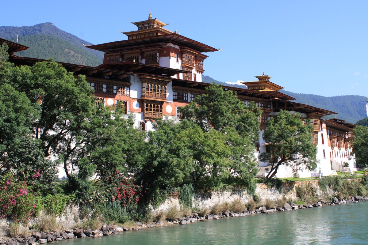
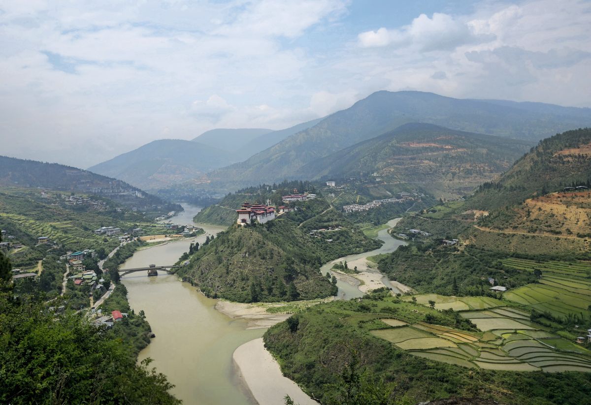
A river's colour is data before it's scenery. Pale grey-green water usually means glacial flour, rock ground to flour-fine silt by ice and carried off in the meltwater; clearer water has usually gone through soil and root systems on its way down from rain rather than off the base of a glacier. At Punakha, two rivers carrying two different colours run alongside each other for a few hundred metres before they commit to becoming one river, and a dzong built in 1637 sits on the spit of land between them, apparently unbothered by which current it's guarding.
Mo Chhu and Pho Chhu: A Confluence, Not a Marriage
Zhabdrung Ngawang Namgyal chose this exact wedge of land for Punakha Dzong, and the choice was strategic long before it was scenic: a confluence is a chokepoint, easy to defend and easy to provision from two valleys at once. Bhutanese locals call the river on the dzong's western flank the Mo Chhu, the mother river, and the one on the eastern side the Pho Chhu, the father river. It's a tidy pairing, gendered and symmetrical, the kind of naming that survives centuries because it's memorable rather than because it's accurate.
The Mo Chhu earns its colour honestly: it runs cold and grey-silted, glacial meltwater still carrying the rock flour it picked up under the ice. The Pho Chhu looks calmer from the footbridge, and that's exactly the problem with judging a river by its surface. Its water comes down from a chain of glacial lakes further north, several of them dammed by nothing sturdier than loose glacial debris, a moraine, which is a wall built by a glacier that was never engineered to hold water back on purpose.
Pop quiz, if the guidebook is still leaning on gentle mother, fierce father: which of these two rivers has actually done the damage here? Not the grey one everyone photographs and calls temperamental out of habit. On the morning of 7 October 1994, a moraine dam on a lake called Lugge Tsho gave way, and the flood came down the quiet river, the Pho Chhu, the one named for temperament rather than for what it's capable of.
The Bridge That Keeps Getting Rebuilt
Twenty-one people died in that flood. The water that came down the Pho Chhu that morning didn't just threaten the dzong, it reached it: the foundations, the courtyard walls, and parts of the structure itself took damage from a river that, on an ordinary day, a monk could wade across. Downstream, the flood took out bridges, homes, and farmland along the valley floor. This is what a glacial lake outburst flood, a GLOF, actually is: not a slow flood from heavy rain, but a sudden release when a natural dam fails all at once.
The bridge in the photo isn't ceremonial, whatever the prayer flags suggest. Punakha's crossings have a documented habit of not surviving the valley's floods: an earlier bridge here was washed out by a GLOF in 1958, decades before Lugge Tsho repeated the lesson in 1994. The valley's current wooden cantilever bridge, the Punakha Bazam, among the longest of its kind in the country, was rebuilt in 2008 on a reinforced concrete foundation, with boulders and concrete blocks set into the riverbed specifically to blunt the next flood before it reaches the piers.
Pop quiz: why pour concrete under a wooden bridge in a valley famous for its old-growth timber joinery? Because Punakha sits inside what hazard planners call a red zone, a stretch of river still downstream of glacial lakes that haven't finished draining. The wood is tradition. The concrete underneath it is an admission that 1994 was not a one-time event.
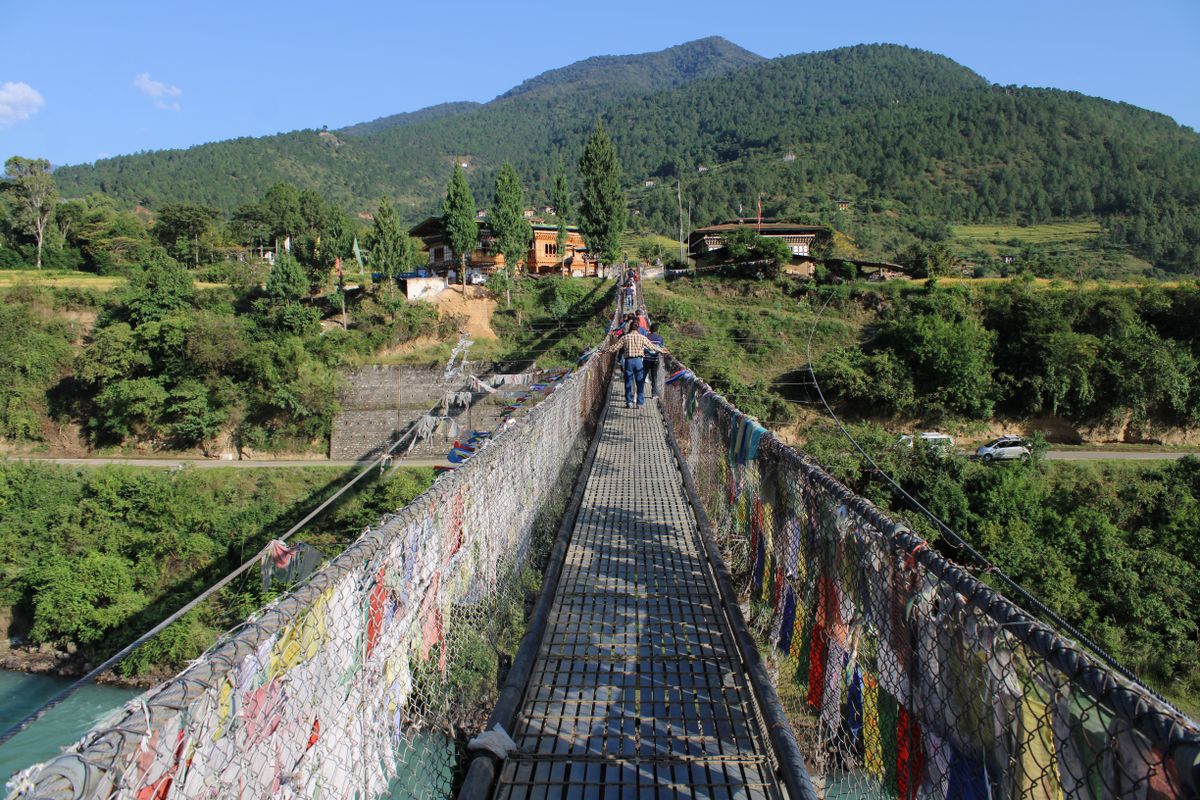
The father river is the quiet one, and it's also the one that has killed people.
— Freya Lindqvist
The Valley Below: Paddies on Borrowed Silt
Below the dzong, the valley floor is terraced into rice paddies fed by the same two rivers that meet at the confluence above them. The grey silt that makes the Mo Chhu look cold and uninviting from the bridge is, a few kilometres downstream, exactly what makes this soil productive: glacial flour is mineral-rich, and floodplains that get resupplied with it every monsoon don't need much help staying fertile.
Field data
Punakha Dzong is generally open to visitors from about 9am to 5pm on non-ceremonial days; dress modestly, shoulders and knees covered, no shorts.
Reached by road from Thimphu, roughly a 3-hour drive over the Dochula pass.
Bhutan's Sustainable Development Fee runs at $100 per person per night for most international visitors, on top of guide and accommodation costs.
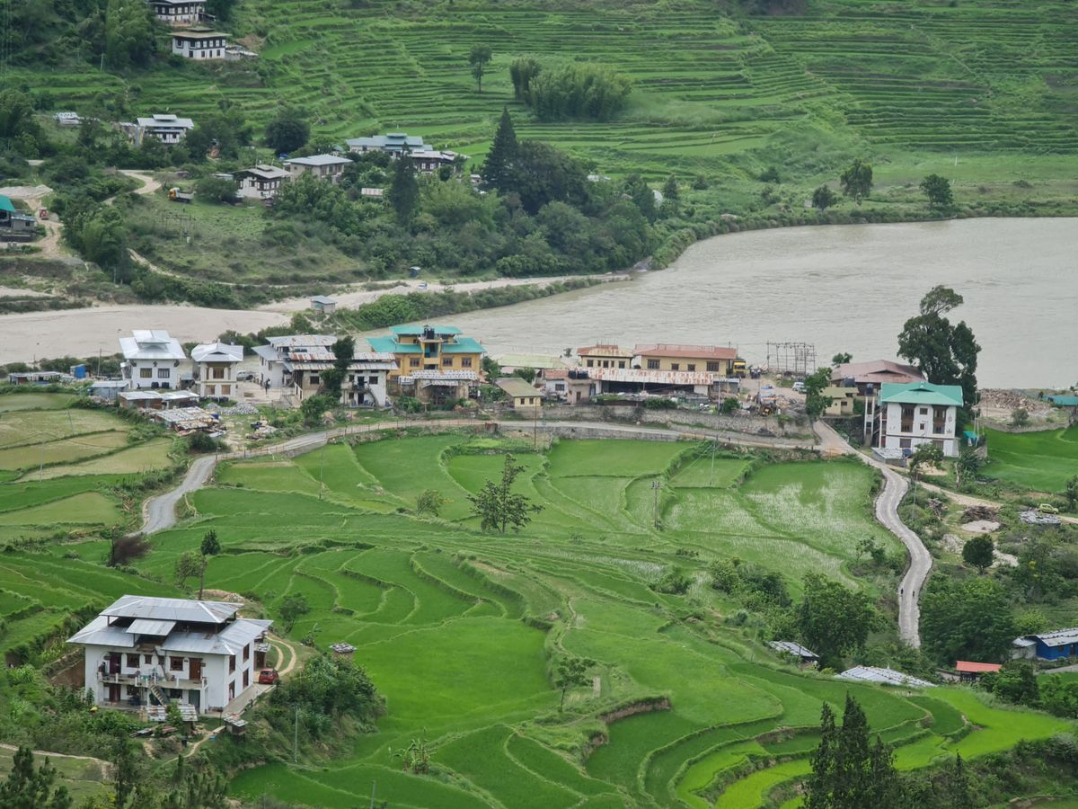
It's a strange arithmetic to sit with, once you've read the plaque about 1994: the same hydrology that killed 21 people and took out a bridge is the reason there's a rice terrace here at all instead of bare rock. Rivers that carry glacial silt build valleys as reliably as they occasionally wreck them. Neither behaviour is the exception.
Pop quiz, last one: does the risk from Lugge Tsho and the other glacial lakes above Punakha still exist? Yes. Early warning monitoring has gone in upstream since 1994, and the concrete under the Bazam is doing its job, but the lakes are still there, still dammed by moraine, still upstream of a dzong that has already been rebuilt once because of them. The rivers haven't signed anything. ■