The Rhyolite Is Not Painted
Laugahraun, 1477
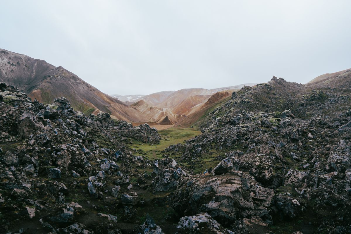
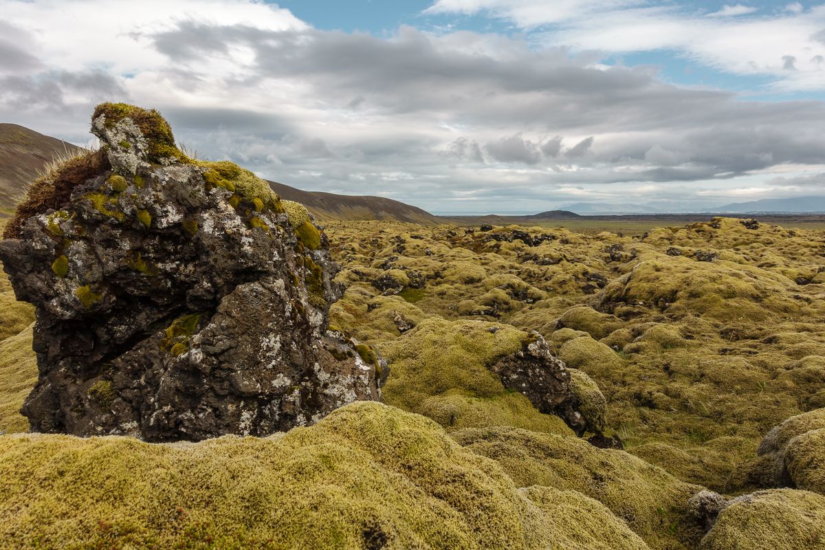
Moss is not a clock, though almost every guide at the hut treats it like one. Woolly fringe-moss, Racomitrium lanuginosum, can blanket a fresh rhyolite-basalt flow in a few centuries if the climate cooperates; a thick, unbroken cushion of it does not require ten thousand years, only patience and enough Icelandic drizzle to keep the spores in business.
I came in on the Trex highland bus from Hella, the kind of ride where the driver stops twice to check a ford before committing the vehicle to it, and where the paved road simply stops being paved about forty minutes in. F208 crosses three unbridged rivers before it reaches the car park at Landmannalaugar; the water sat mid-shin on the axle gauge painted on the ford post, which the driver read like a tide table.
A guide ahead of me on the boardwalk called Laugahraun 'ancient,' the sort of word that gets attached to any lava field wearing a good coat of moss. Icelandic annals record the eruption as 1477, a fissure event tied to the Veiðivötn-Bárðarbunga swarm's southern extension where it runs into the edge of the Torfajökull complex. That is not ancient by any definition a geologist would sign off on. Medieval, if anything: the flow is younger than Notre Dame's nave.
Pop quiz, since the trail sign declines to ask it: what's the actual age of a lava field that looks like it's been sitting there since the last ice sheet retreated? Five hundred and forty-nine years, this July. Wear a coat and it'll still look older than you.
The River Everyone Mistakes for Something Else
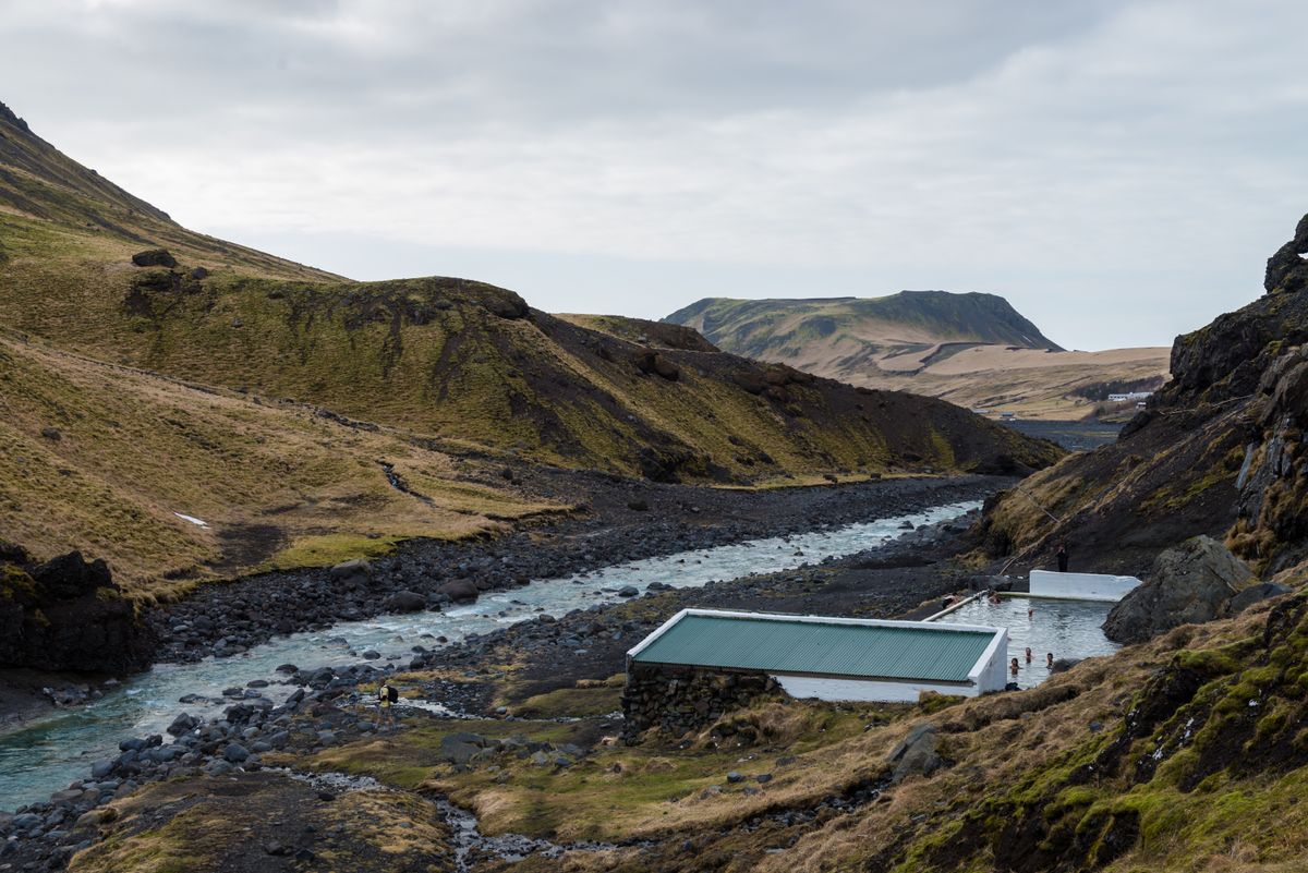
Geothermal water at Landmannalaugar does not come from a power plant's silica pond; it comes from rain and snowmelt that sank through fractured rhyolite, sat against a cooling body of magma under the Torfajökull complex until it picked up heat, and returned to the surface along the same fault system that put Brennisteinsalda where it is. No pipes, no filtration, no admission turnstile beyond a fee box at the hut.
The bathing spot sits where that warm outflow meets the cold glacial river coming off the highlands, and the two currents don't fully mix. You can stand in one square meter of water that's bath-warm on your left leg and genuinely painful on your right, which is either a design flaw or the entire point, depending on how long you've been hiking. The changing hut is a plywood box with two doors and a sign asking you not to bring soap into the water; forty-odd people were queued for it the afternoon I went in, most still in their boots.
Two separate people asked me, unprompted, if this was 'the Blue Lagoon place.' It is not. The Blue Lagoon is geothermal seawater discharged from the Svartsengi power station, engineered and silica-cloudy by design, ninety minutes from Reykjavík near Grindavík. This is an unmanaged confluence of two rivers in the central highlands, four hours from the capital on a road that closes for winter. The color alone should have settled it: this water runs clear over black sand, not milky turquoise.
Pop quiz: what percentage of a hot-cold confluence pool actually mixes before you get in? Less than you'd hope. Pick your square meter carefully.
One day and one night, Landmannalaugar
Brennisteinsalda: The Mountain Still Deciding What Color to Be
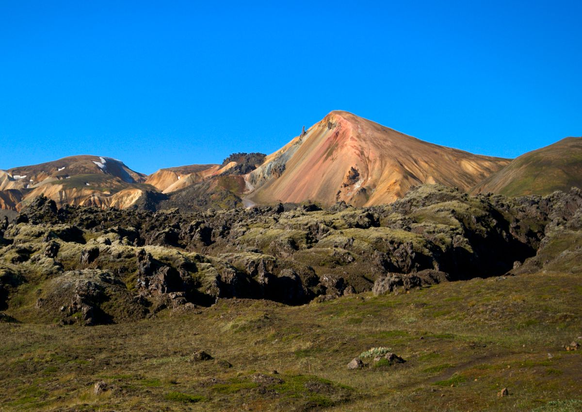
Brennisteinsalda means brimstone wave, and both halves of the name are literal. It's a rhyolite lava dome, part of Torfajökull, the largest rhyolite volcanic complex in Iceland by exposed area, and its colors are the visible record of an active hydrothermal system still altering the rock today, not a one-time paint job finished long before Laugahraun's basalt buried its lower slopes in 1477.
The climb to the 855-meter summit switchbacks through a slope where the ground temperature changes as often as the color does. Sulfur smell arrives before the yellow does. Underfoot the rhyolite goes from black obsidian glass to rust red to a green so specific it looks synthetic, and every ten meters or so a fumarole vents enough heat that the path detours around it rather than through it.
A woman on the trail asked her companion if the colors were 'like a dye they use for photos.' They are not. The red and orange bands are hematite and other oxidized iron minerals; the yellow is elemental sulfur crystallizing straight out of the steam; the green comes from altered volcanic glass and iron sulfides reacting with acidic groundwater. None of it needed a filter. All of it is still happening, which is the part the postcard doesn't capture: come back in twenty years and the boundaries between the bands will have shifted, because the system depositing them hasn't stopped.
Pop quiz: how do you tell an extinct hydrothermal feature from an active one at a glance? The dead ones don't smell of anything. Brennisteinsalda smells like a struck match the whole way up.
The sulfur and the iron are still arguing about what color Brennisteinsalda should be.
The Track North, and What to Pack for a Volcano Still Working
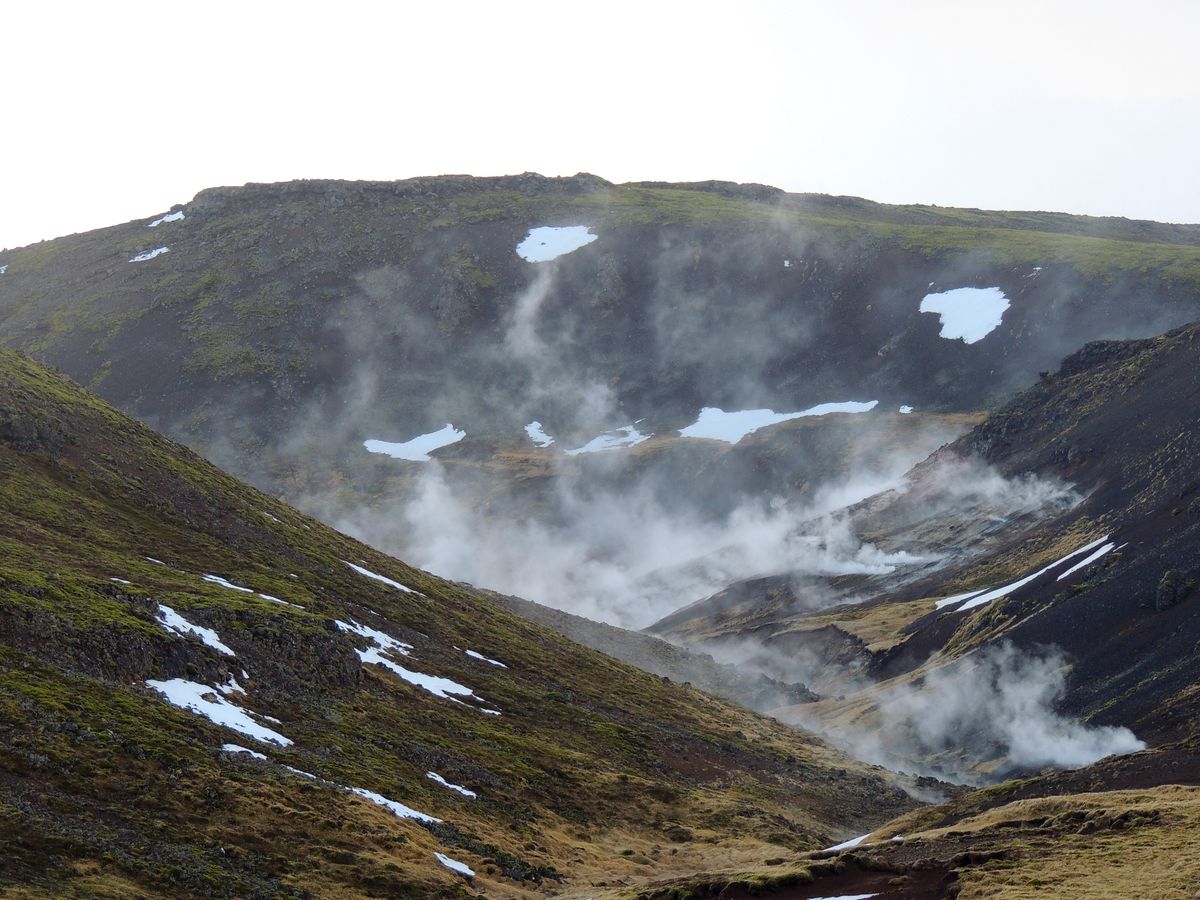
Steam at the fumarole field north of the hut is groundwater flashing to vapor the moment it meets rock still warm enough to do that to it, and the same mechanism keeps snow patches alive on shaded slopes well into July at 600 meters, an elevation that would otherwise have gone bare by June.
Landmannalaugar is kilometer zero of the Laugavegur trail, 55 kilometers north to Þórsmörk over four days if you keep to the Ferðafélag Íslands hut schedule, which you should, because the huts are booked out by February for the following summer and turning up without a reservation gets you a very cold, very scenic night in a tent instead. I'd booked the first leg to Hrafntinnusker, 12 kilometers and roughly 470 meters of climb through a stretch of obsidian scree the warden at the hut desk described, accurately, as 'not technical, just relentless.'
Field data
The road usually opens in the second half of June and closes at the first proper snow, often by mid-September; check road.is rather than trust a rental agreement's optimism.
There are at least two unbridged fords on the approach; a 2WD sedan will not clear them regardless of the driver's confidence.
Daytime highs of 12°C and overnight lows near freezing occur on the same date. Pack for both, not for the average.
None of this made me feel small in the way the brochures promise. Mostly it made me annoyed that I'd left my proper gloves in the rental car back in Hella, and cold hands are cold hands whether the ground under them is nine millennia old or five hundred and forty-nine. ■