Chapada Diamantina: What the Water Actually Tells You
Field notes from Bahia's plateau country, where a waterfall arrives as mist, cave pools run impossibly clear, and the instincts that read a reef still apply on dry land.

Water at Poço Azul, eleven in the morning, sun close enough to overhead to reach the cave floor: visibility straight down to a bottom I'd put at maybe eighteen meters, no mask needed to see the shape of it from the platform, cold enough on entry that I felt it in the first ten seconds and not before. No coast for four hundred kilometers in any direction, plateau and canyon instead of reef and current. Same read anyway. Clear water has a reason to be clear or it doesn't, and finding out which is the same job whether you're twelve meters down on a reef or standing on a limestone lip in Bahia state looking at cave water that shouldn't be this see-through and is.
Chapada Diamantina isn't a coastline, it's table-mountain plateau cut into canyons, waterfalls and flooded caves instead of reef flats and drop-offs. I spent the trip moving between three kinds of water: a waterfall that arrives as mist, two underground wells lit from above, and a trail that shows you, at eye level, why the whole park is shaped the way it is.
Field Note: The Waterfall That Arrives as Mist
Ridge trail toward Cachoeira da Fumaça, full day out and back from near Palmeiras: four lookout points before the true one, wind picking up after the second, and at the true one you don't see a waterfall so much as you see what wind does to one. The fall drops around 340 metres off the plateau edge, and by the time that water is a third of the way down it isn't a column, it's spray, moving sideways whenever the canyon breathes. I watched for maybe twenty minutes and never once saw a continuous line reach the ground. Smoke is the right word for it. Not poetic, just physics: a thin flow, a long drop, enough air in between to catch it.
Two different guides on the ridge called it the tallest waterfall in Brazil, no qualifier, both saying it like a fact they'd stopped checking. It's one of the tallest, not the tallest outright, and the distinction matters more here than at most sites because you never get the comparison your eyes usually rely on. There's no base to stand at, no scale to eyeball it against. You stand at the top, you watch mist move, and you take the number on faith like everyone else on that ridge.
Verdict: worth the full day of walking, but know what you're buying, it's a wind reading, not a waterfall you'll ever see complete.
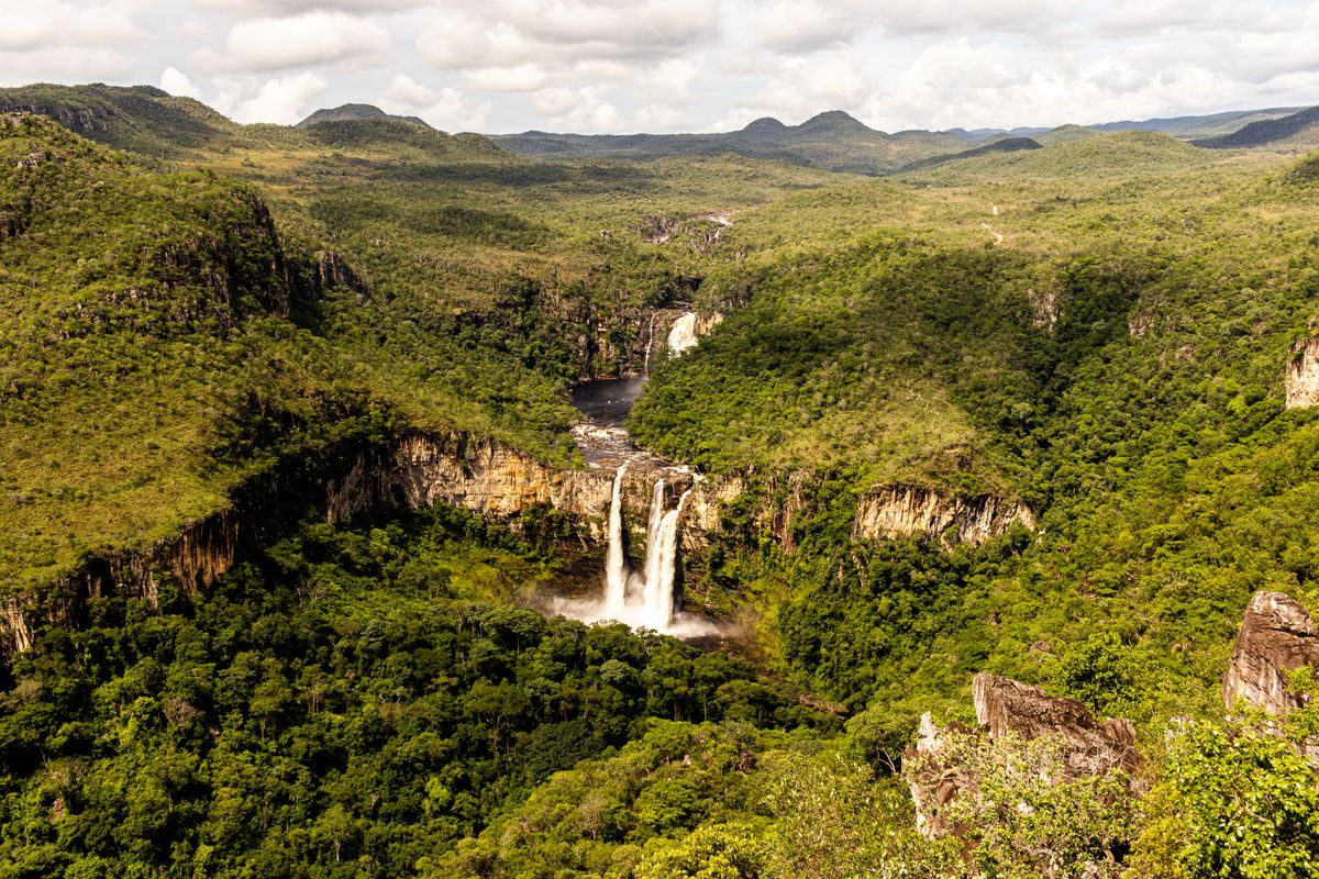
Smoke is the right word for it. Not poetic, just physics: a thin flow, a long drop, and enough air to catch it.
Field Note: Two Wells, Read Differently
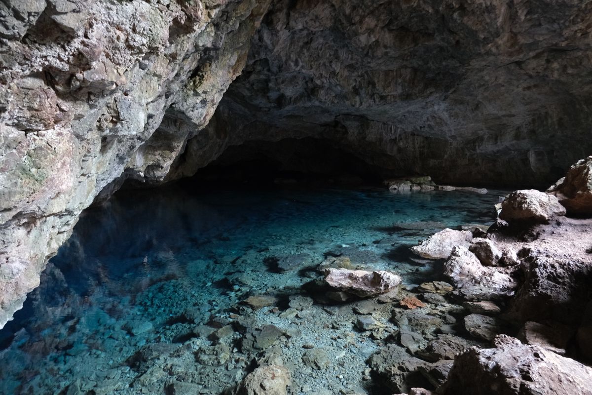
Getting into the wells
Poço Azul and Poço Encantado sit near Nova Redenção, roughly 50km from Lençóis. Book a local guide for both, neither is a walk-in site.
Bring your own mask if you have one, the rental sets at Azul were mismatched sizes the day I went.
Midday works best for the light, guides told me the same thing at both wells and my photos back it up.
Water at Poço Azul again, same visit, same platform: four other snorkelers in with me and I could pick out every fin from above the surface, no particulate haze at all between us. The blue isn't a filter and it isn't paint on the rock, it's sunlight coming through the entrance opening and finding a pale limestone floor with almost nothing suspended in the water to scatter it first. Poço Encantado, a short drive on, is the same mechanism and a different rule: viewing platform only, no entry, the blue read from above instead of from inside it.
A group of eight showed up at Azul in full wetsuits for water that wasn't especially cold and visibility that didn't call for one. One asked our guide if the blue was natural or added to the water. It's light and limestone. That's the entire trick, and it isn't actually a trick, it just looks like one from a platform.
What I'd go back and get a real number for: the actual depth at Azul, with a line instead of an eyeball guess. Eighteen meters is what I'd put money on from the platform, but I didn't bring anything to check it against, and a guess dressed up as a measurement is worse than no number at all.
Verdict: Azul for getting in the water, Encantado for the view you don't get to touch, both worth the detour out of Lençóis.
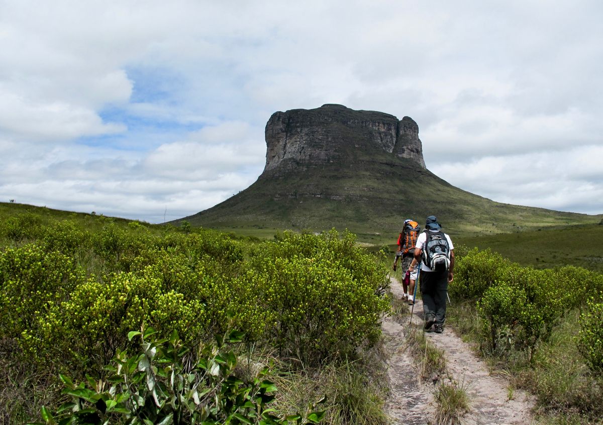
Field Note: The Trail That Explains the Park
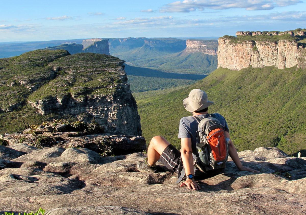
Trail toward Aguas Claras, mid-afternoon, red dirt underfoot: six morros standing clear of the scrub between the trailhead and the first stream crossing, flat-topped, sides too steep for anything but lichen and low scrub to hold on to. Cerrado grass at ankle height the whole way, no shade until the water. Structurally it's the same read as a coastline in profile, harder rock capping softer rock underneath, whatever erodes slower decides the shape everyone ends up photographing.
I'd seen the same formations from above two days earlier, from the top of Pai Inácio after a short climb, canyon country laid out under a line of table mountains going pale with distance. At eye level on the Aguas Claras trail it's the same geology minus the vantage, rock reading as rock instead of scenery. One pair on the trail wore matching ponchos under a cloudless sky, ready, apparently, for a forecast nobody else had received.
Verdict: less dramatic than the waterfall, less blue than the wells, but it's the site that actually shows you why the rest of the park looks the way it does.
What I'd actually go back and check: the depth at Poço Azul with a real line, and whether those four lookout points before Fumaça's true one are counted the same by every guide on that ridge, because I got two different counts in one afternoon and neither guide seemed bothered by the gap. Everything else out here read the way water reads anywhere. Clear for a reason, or clear because nobody's tested it yet. ■