Zermatt Under the Matterhorn, and a Cable Car Up to the Glaciers
A day in Zermatt, the Swiss village under the Matterhorn, and the relay of cable cars that climbs from it to the glaciers above the cloud.

07:40 on my watch, and I was stepping off the rack railway from the valley town of Täsch onto the platform at Zermatt. Zermatt is a Swiss village of about 5,800 year-round residents, 1,620 metres up at the head of its valley, and combustion-engine cars are not allowed anywhere in it. Almost every vehicle is battery driven and nearly silent, and the rule exists to keep air pollution from obscuring the view of the Matterhorn.
The Matterhorn, 4,478 metres above sea level, is a near-symmetric pyramid of rock straddling the border between Switzerland and Italy. People come to Zermatt to stand under it and to be among glaciers and 4,000 metre peaks without being mountaineers, and a relay of cable cars does the climbing. It ends at the Klein Matterhorn, a 3,883 metre summit that is the highest place in Europe a cable car or gondola can reach. I had one day in September and no climbing skill.
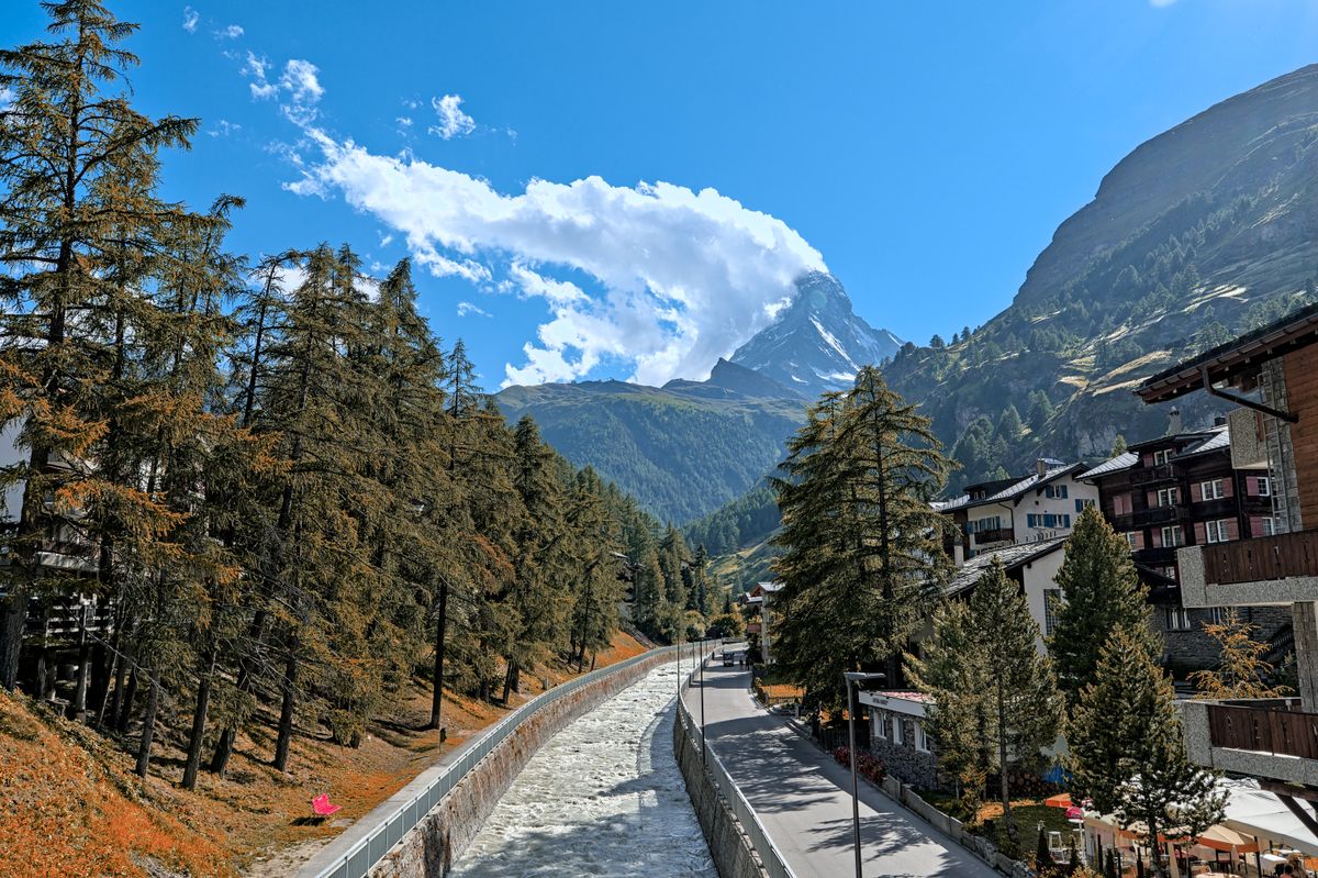
The village, before the lifts
From the platform I walked, since in Zermatt almost anything is at most a thirty-minute walk away, and the street was quiet enough that I could hear the grey water running in the walled channel beside it. Under the larches on the other side of the channel the ground cover had already gone orange. At the end of the valley the Matterhorn had a white cloud hanging off one side of its summit.
The name is often translated as the peak of the meadows, from the German word Matte, a meadow. It has also been claimed to be the most photographed mountain in the world, and I took a few for the count before walking on to the lifts. The first ascent was in 1865, from Zermatt, by a party led by Edward Whymper.
The lifts, in cloud
The lifts go up in stages, by way of a station called Furi. Somewhere above it the cloud came in, and at Trockener Steg, the station where I changed for the last cable car, I made a controlled descent into the wrong queue, no injuries. A woman from the line behind me steered me out of it by the elbow. She was a retired teacher called Margaret, travelling alone, and she nodded at the grey outside and said, "It opens without warning, you'll see."
Under the cloud, the mountain that had been white from the village was dark, bare rock above a stony basin, with a small pond of meltwater in the stones.
The last cable car began running on 23 December, at the start of the 1979 winter season. Its mountain station took some 2,000 cubic metres of concrete, all of which had to be flown up by helicopter in specially insulated tanks. I thought about that in the cabin, with the cloud pressed against the glass.

The glacier, closer
By the top the cloud was below us and the sky was clear. The last station sits at 3,820 metres on the north side of the Klein Matterhorn, and a tunnel runs from it to the Breithorn Plateau on the south side, a flat shelf of glacier at around 3,800 metres. An elevator halfway along the tunnel and then 10 metres of stairs lead up to the viewing platform on top, and I took the stairs slowly.
briefing notes
Fast ascents above 3,000 metres frequently give sensitive people a headache, so take the top slowly.
The Ice Cave, also called the Glacier Grotto, is just outside the southern entrance of the mountain station, with a view into the glacier below.
The Gornergrat Railway, a rack railway from Zermatt, is a second way up and the highest open-air railway in Europe. Its top station stands at 3,089 metres, surrounded by 29 peaks above 4,000 metres.
Flight log: we broke out of the cloud, the cabin went quiet, and a phone beeped.

From up there a glacier ran toward me in one long curve between dark ridges, with brown stripes of rock riding on the ice and a range of snow peaks behind it. I could not have told you the name of the ice or of a single peak. ■